Live on 70%+ of the Belgian demersal fleet
Co-funded by

European Union and Flanders.

Nautical · Analytics · Vessel · Intelligence

The data your vessel already generates. Finally working for your business.

One box on board. A complete data picture for your fleet, your science, and your sector.
  • Skipper less paperwork, operational insight
  • Science research-grade data, every trip
  • Policy the evidence base Europe demands
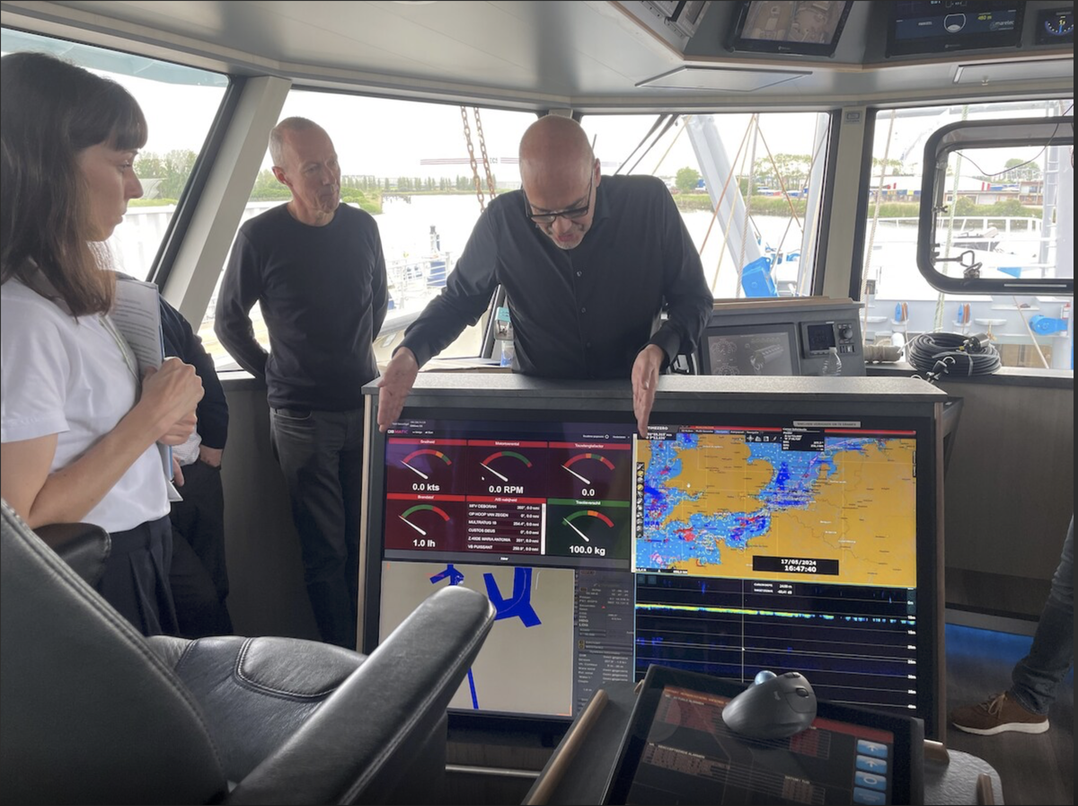
Vessel bridge view
70%+
Of the active Belgian demersal fleet running NaviTools today
2026
Ready for the EU traceability obligation in force this year
EU
Recognised at EU level as an example of data-driven fisheries
ILVO
Scientific collaboration on research-grade data integration
Enabled by Data Processing Technology
01 — The problem

Fishing vessels generate valuable data. Most of it is lost at sea.

While compliance requirements grow, the data needed to meet them is already being produced on board. It simply never reaches the people who can act on it.
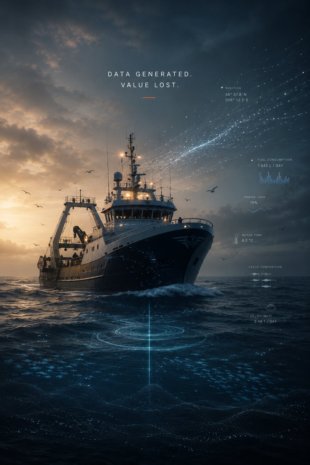
A trawler at sea, surrounded by data overlays — data generated, value lost
  1. 01 Compliance EU traceability mandate from January 2026 — data required, not yet captured at sector scale.
  2. 02 Operational cost Margins erode trip by trip with no per-haul fuel evidence on board.
  3. 03 Political risk Quota debates run without operational evidence from the fleet.
  4. 04 Scientific gap Stock models rely on infrequent surveys, not continuous fleet data.

NaviTools was built to capture this missing data layer.


02 — For the fisherman

The technology that takes work off the deck.

NaviTools was conceived by a former skipper. Every feature is measured against one question: does it save time, money, or trouble on board?
Direct value, every trip

Less paperwork. More margin. Real protection.

  • Your e-logbook data, prepared for you. Position, depth, gear, species, weights and discards are captured from sensors all trip long. When it is time to submit the e-logbook, the fields are ready — you confirm, you do not type.
  • Full EU traceability, hold to buyer. NaviTools delivers the complete traceability solution the EU now requires. Each box is fixed to a position in the hold (FishGrid), scanned once by RFID at landing, and tracked through the auction to the buyer — end-to-end, on every trip. Already implemented on five vessels (below).
  • Fuel cost per haul, per trip, per kilo of fish. Liters per hour live. Liters per kilo of catch the moment a haul comes on deck. Spot the tow that earned nothing. See in euros whether a hull cleaning, a new propeller or a different RPM actually paid back.
  • Evidence on file before it's asked for. Net damage, gear loss, auction-weight disputes, near-misses: position, depth, course, hydraulic pressure and per-box catch composition are timestamped and stored. Insurance, surveyor, lawyer — the record is there when they need it.
  • Your grounds, mapped from your own hauls. Catch-per-hour by depth, bottom type and season — built trip after trip from data you already generate. The pattern no skipper can hold in their head over a 20-year career, written down and searchable.
  • Margin per trip, while you are still fishing. Catch value minus fuel burn minus crew share, recalculated as each haul lands. Visserij Verduurzaamt premium tracked separately. Stay or steam — decide with numbers, not just gut feel.
Pedro Rappé — skipper on deck NaviTools BleuBox installed on a vessel, wired to the onboard data concentrator
Precedent — running in production

Full traceability is not a plan. It is already implemented on five vessels.

Click a vessel for deployment details.
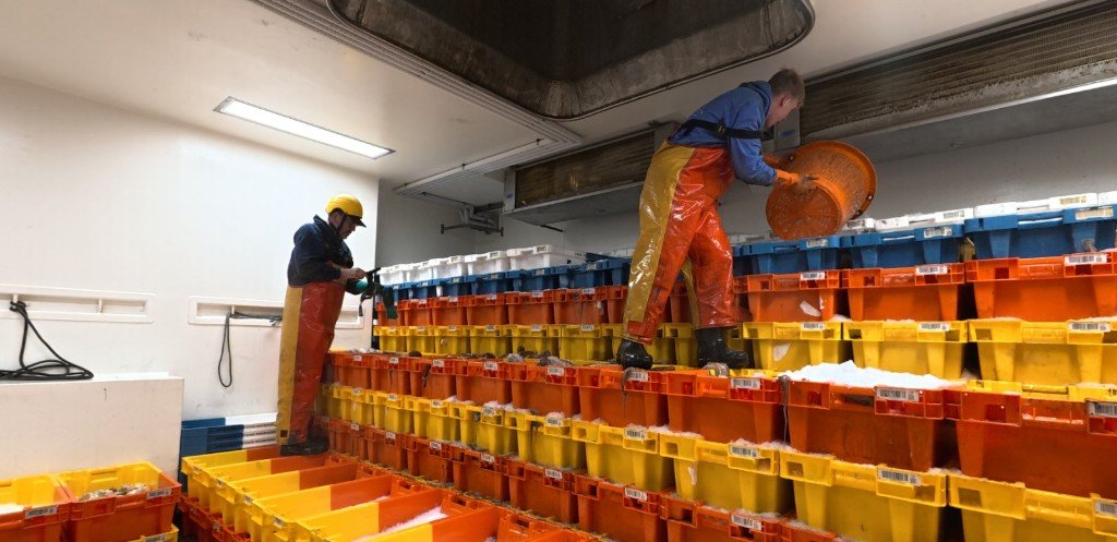
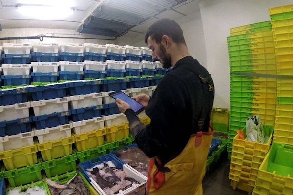
Crew positioning fish boxes in the hold
Boxes positioned in the hold against FishGrid coordinates.
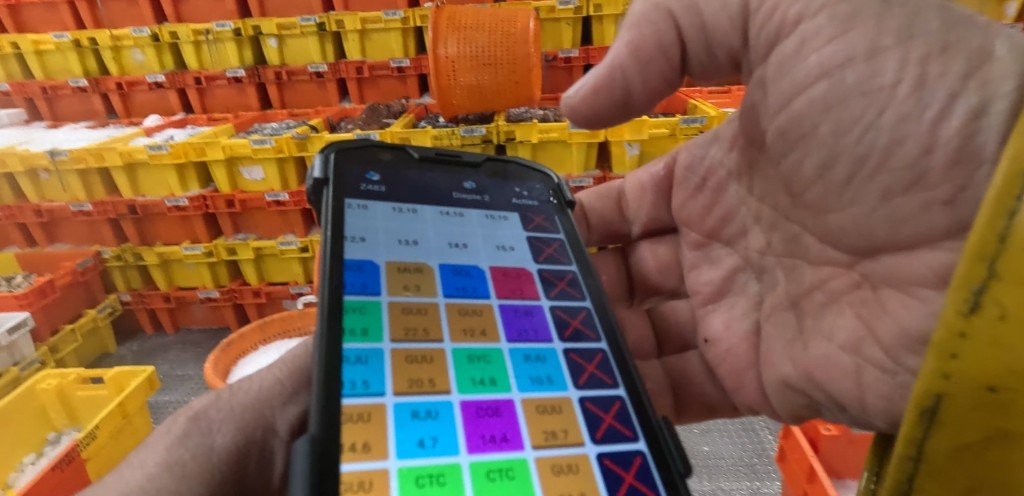
Skipper logging a box on the FishGrid app — colour-coded species grid
On-deck logging — species, weight and condition recorded per box.
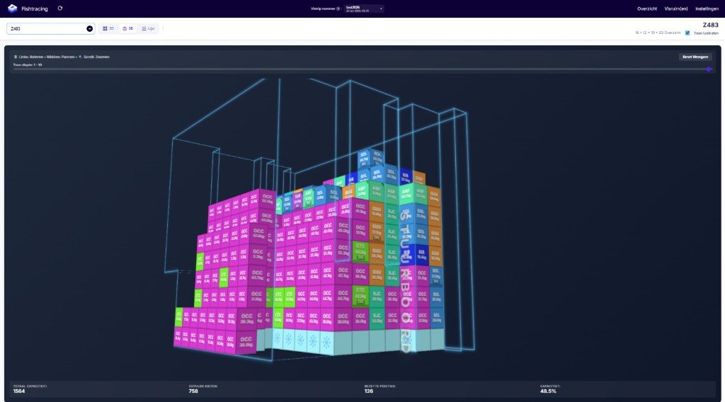
3D digital twin of the Z483 hold with every box mapped to its slot
Real-time 3D twin of the hold — every box pinned to its slot.
03 — For the community

The same data, working for the sector and for the science.

NaviTools catch data in action
Beyond the wheelhouse, NaviTools strengthens the institutions that the fishing community depends on — producer organisations, scientific institutes, and the European policy framework.
Sector & governments

Transparency as the foundation of trust.

  • Demonstrable practice: what is caught, how, and under what conditions.
  • EU 2026 ready — traceability obligation built in from day one.
  • Sustainability indicators: fuel intensity, seabed contact, bycatch.
  • Recognised by ICES and at EU level as an example of data-driven fisheries.
Science & policy

Real-time data for assessments that matter.

  • Stock assessments enriched — faster and more granular than traditional surveys.
  • Modular architecture in collaboration with ILVO and international research institutes.
  • Certified data governance — vessel owners retain full ownership.
  • Open scientific pipelines — no black boxes; models stay transparent.
04 — What sets it apart

Built on deliberate choices — not on hype.

NaviTools is a system, not a single product: vessel-hardened hardware, enterprise cloud, open-source scientific modules, and a new generation of AI tools that turn raw signal into decisions.
NaviTools purpose-built hardware unit
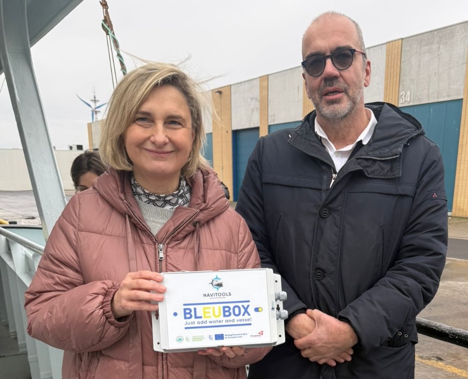
Minister of Agriculture & Fisheries Hilde Crevits holding the BleuBox, with Pedro Rappé.
01

Purpose-built hardware

Purpose-built collection unit, hardened for working vessels. Dedicated processing, minimal maintenance, long service life.
NaviTools cloud network infrastructure
02

Industry-standard cloud infrastructure

Data processing and storage on enterprise-grade cloud infrastructure — the same standards used by global research institutions and governments. Reliable, scalable, auditable.

Diagram: Research methods as a module. Data input → data prep → research methods (a plug-in module the user chooses) → results → delivery → decisions. Plug in. Process. Decide. Swap in different methods as needed; same pipeline, more flexibility.
03

Open-source scientific integration

Research modules — stock assessment, species distribution, environmental data pipelines — plug in as modular, open-source components. No black boxes.
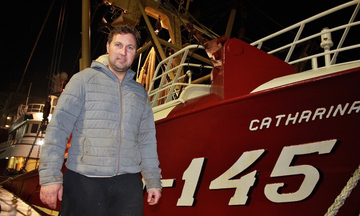
Skipper Geert van der Plas, W-145
"W-145's skipper Geert van der Plas is positive about the benefits of gathering data."
04

Designed by fishermen, for fishermen

Conceived from the deck up, by a former commercial skipper. Practical first, data-rich second, complex only when necessary.

Diagram: vessel data enters an encrypted vault; the skipper decides who is authorised — research institutions and data processors get read-only, time- or purpose-limited access; regulatory bodies and public third parties are not authorised. Every access is audit-logged.
05

Certified data governance

Vessel owners retain full ownership of their data. They decide who accesses it, on what terms, for which purpose.

06 — In active development & deployment

Agentic AI and advanced modelling

AI agents handle the heavy work: crunching trip data, building dashboards, running predictive models that sharpen as more vessels contribute. On deck, the same agents make that data accessible in plain language — a skipper or fleet manager can ask a question and get an answer on their own phone or tablet. No new interface to learn — the data comes to them.
05 — Proof

Not a pilot. A platform at fleet scale.

VisTools, the Belgian implementation of NaviTools, is one of the most widely deployed vessel data systems in European demersal fisheries — live, in daily use, and adopted at scale.
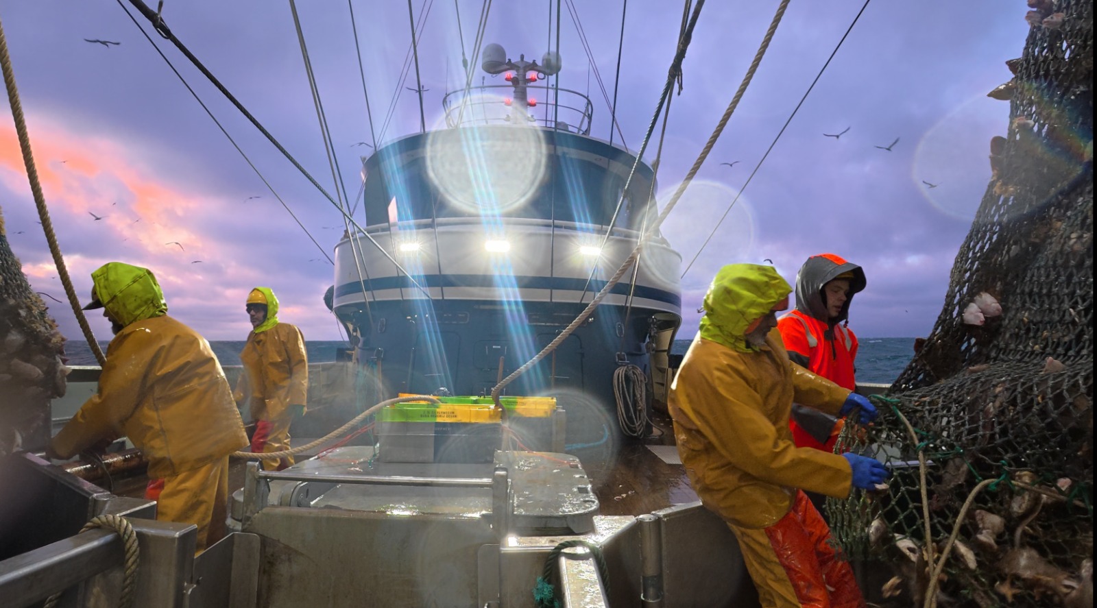
Belgian fishing vessel at sea — NaviTools fleet
70%+

of the active Belgian demersal fishing fleet runs on the NaviTools platform today.

Source: VisTools deployment, 2026 · Belgian demersal fleet, active vessels
Scientific partner
Flemish Institute for Agricultural, Fisheries and Food Research
Industry backing
Belgian fishing industry producer organisation
European recognition
Cited at EU and ICES level as an example of data-driven fisheries
Funding
With financial support from the European Union, ZeeBONK, Provincie West-Vlaanderen and Agentschap Landbouw en Visserij
Active deployments — fleet coverage
100%

NaviTools is live on 70%+ of the active Belgian demersal fleet, with growing coverage in the Netherlands.
VIStools — intelligence layer
VIStools — vessel as data platform

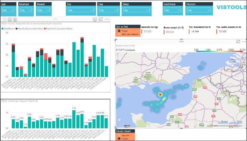
VIStools is the research and skipper-facing analytics platform built on the NaviTools BleuBox data concentrator. Automated sensor data from each trip feeds a live view of catch composition, fuel consumption, and revenue per haul — accessible on board and online.

The rationale — from the field

Is this the Tech to build a Regenerative Fishery?

What Regenerative Fishing Could Actually Look Like

06 — Partners & ecosystem

Working with the institutions that shape European fisheries.

Technology, sector, research and public stakeholders supporting the NaviTools platform.
ILVO logo
European Commission logo
Provincie West-Vlaanderen logo
Agentschap Landbouw en Zeevisserij logo
Wageningen University and Research logo
Visserij Verduurzaamt logo
07 — Press & recognition

In the press. At EU level. In daily use.

A selection of features, interviews and institutional references covering NaviTools, VisTools, and the BleuBox data concentrator.
08 — Get in touch

Let's talk about what your fleet's data can do.

For institutional partners, governments, funders and international organisations. We typically respond within two business days.

Email
info@navitools.be
Based in
Belgium · serving Europe and beyond